Italian National Agency for New Technologies, Energy and Sustainable Economic Development

MEDIA - Press office ENEA
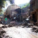
Environment: Geo-hydrological instability, ENEA develops innovative models to identify areas of propagation and impact of debris flows
An ENEA research team has developed a new approach to determine the propagation area and intensity of debris flows, a particular type of highly destructive fast landslides and is testing new methods to assess their trigger thresholds based on the water content of overburden[1].
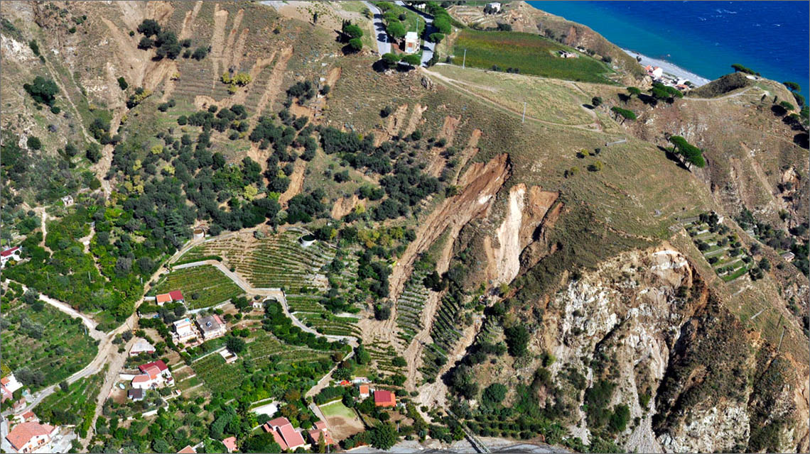
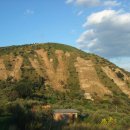
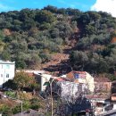
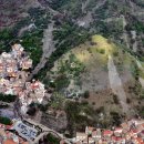
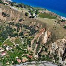
The innovations aimed at drawing more accurate hazard maps than those currently in use to manage alerts in civil protection systems and territorial planning are the result of over twenty years of geomorphological studies on debris flows conducted by ENEA researchers; among the most important, those to support Civil Protection following the landslides of 2009 in Sicily where inspections, investigation campaigns and studies were conducted, leading to the creation of landslide hazard maps[2], later implemented in the Messina General Regulatory Plan of 2015.
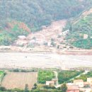
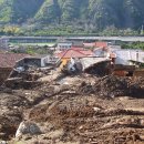
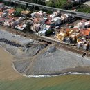
The innovative aspects that emerged from these studies have recently been tested and further developed as part of the project RAFAEL[3] for risk prediction and management of critical infrastructures in Southern Italy. In this context, ENEA has produced hazard maps for debris flows in the two basins of Giampilieri and Briga (Messina), focusing on the assessment of runout distances of landslides, on the identification of propagation areas, where the greatest damages occur, and on the relative expected intensity in terms of destructive potential.
At the heart of the project is the development of a segment of a decision support system based on open source GIS software which, starting from the trigger susceptibility maps, draws the propagation maps of the expected landslides. Specific GIS tools allow to automate processing in a matter of minutes, and the hazard assessment can be continuously updated on the basis of rainfall data from the national monitoring network.
“Debris flows are increasingly dangerous natural phenomena because they are directly linked both to the intensification of extreme events, climate change and many human settlements close to watercourses, as well as depopulation of mountain areas and consequently lack of slope stabilization works[4]”, pointed out Claudio Puglisi at the ENEA Laboratory of Technologies for the Dynamics of Structures and the Prevention of Seismic and Hydrogeological Risk.
"That’s why we hope for the systematic adoption of risk mitigation measures which, starting from hazard maps, identify the most suitable structural and non-structural measures, including more resilient urban planning choices, early warning systems and civil protection plans ”.
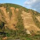
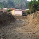
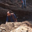
The second innovation, on the other hand, consists of a hydrological balance model of the overburden capable of assessing the triggering thresholds of debris flows, not only in relation to rainfall, but also on the basis of the water content in the superficial portion of the subsoil. The method, currently being implemented and validated as part of an agreement with the Sicilian Region[5], will make it possible to analyze how rainfall affects soil saturation which triggers debris flows. In five areas of the Messina territory, measuring stations have been installed which remotely record and transmit the humidity data of the overburden (lisimeters), its temperature at four different depths, the water pressure at a depth of about 1 meter (tensiometers) and rainfall (rain gauges).
“In the face of a growing frequency and intensity of extreme events, exacerbated by climate change and recognized at a scientific level, debris flows are the most dangerous landslides to focus on. Due to their intrinsic characteristics, such as trigger speed, size and velocity, they escape even satellite monitoring systems, which are very useful in the event of slow landslides, and require innovative solutions on which we at ENEA have been working for some time". explained Luca Falconi, of the ENEA Laboratory of Technologies for the Dynamics of Structures and the PREVention of Seismic and Hydrogeological Risk.
The combination of both methodologies will also contribute to predict more accurately the quantity of overburden material flowing into the riverbed for distinct triggering thresholds (both rainfall and water content in the overburden), also contributing to a hazard assessment of flash floods.
What are debris flows?
Debris flows are fast-moving, deadly landslides that travel down on medium slopes, generally between 25° and 50° consisting of a mixture of mud, rock soil, debris, volcanic products, lying on the bedrock. Their main triggering factor is heavy rainfall which leads to soil saturation, with consequent fluidification and sliding reaching a speed of tens of kilometers per hour along the line of maximum value of the slope. During each phenomenon, the covering material is almost completely removed, causing the subsequent rainfalls to activate different stretches of the slope.
Debris flows are closely related to sudden floods (flash floods) and their concurrence can significantly amplify the hazard of the two phenomena. Intense rainfalls can simultaneously trigger flash floods, with sudden increases in flow velocity of small streams considerable amount of solid load and flash flows which, triggered along the sides of the basin, spread downstream, very often merging into the drainage system network. The increase in the solid fraction increases the capacity to transport rocks, even of considerable size, with catastrophic consequences on transversal infrastructures (bridges, ducts, etc.) or in the case of overflow beyond the banks. On the other hand, the erosion caused by the stream at the base of the slopes during these events can trigger other types of landslides which, by pouring into the riverbed, mutually feed the process.
What is overburden?
Overburden consists of loose, uncemented, unconsolidated material, i.e. rock debris and volcanic ash, lying above bedrock. It is generally displaced along the slopes with greater thicknesses towards the valley floor (up to several metres), while it tends to decrease in the higher portion, creating space for substrate outcrops.
Fotogallery
Note
[1] Uncemented and unconsolidated material lying above the bedrock
[2] ENEA-Municipality of Messina Program Agreement for the "Assessment of landslide hazard in the Municipality of Messina" (2011-2013)
[3] System for Risk Analysis and Forecast for Critical Infrastructures in the AppenninEsdorsaL Regions - funded by the MUR (Industrial Research and Experimental Development Projects) and coordinated by ENEA with the Laboratory for the Protection of Critical Infrastructures
[4] Risk mitigation measures are aimed at reducing hazard and concern, for example: reprofiling of slopes, viminate plantings, pilings, dry terraces, subsurface drainage and drainage channels
[5] Scientific collaboration agreement between ENEA and the Sicilian Region (Presidency of the Region - Basin Authority of the hydrographic district of Sicily)