Italian National Agency for New Technologies, Energy and Sustainable Economic Development

MEDIA - Press office ENEA
Earthquake: Digital dashboards, information systems and hi-tech sensors for the resilience of historic centers
Innovative sensors for monitoring earthquakes as well as climate change and extreme events, information system for collating and displaying real time, past and future data, and digital dashboards to inform citizens and Public Administrations about strengthening of city resilience with focus on historic areas that are of invaluable significance, although very fragile. These are some of the results of the Horizon 2020 project ARCH , coordinated by the Fraunhofer Institute for intelligent Analysis and Information Systems IAIS (Germany), where internationally known research institutions such as ENEA (Italy), INGV (Italy), and Tecnalia (Spain) had the opportunity to join their knowledge and expertise and make it promptly available to the stakeholders and communities thanks to the support of the city network ICLEI and of the standardisation organisation DIN (Germany).
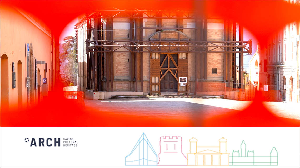
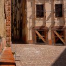
The project tested its results on four pilot cases, 6 years after the of 6.5 magnitude earthquake, one of the strongest in the last thirty years in Italy, that 30 October 2016 stroke central Italy, seriously damaging its precious historic centres: the first case was Camerino (Macerata), whose historic centre was severely damaged, to give a tangible and concrete contribution to support the resilient reconstruction of the built, natural and heritage environments. Other pilot cases included: Bratislava (Slovakia), Hamburg (Germany) and Valencia (Spain) whose historic areas are threatened by climate change and induced extreme events. The ARCH project saw the collaboration in Italy of ENEA, INGV, the Municipality and University of Camerino, Sogesca srl and UNI.
Among the developed innovations:
ARCH RAD a Resilience Assessment Dashboard, an online multi-stakeholder self-assessment tool in the form of a questionnaire that allows assessing the current level of resilience of a historic area; this to support the formulation of action plans for adaptation to climate change and disaster risk management of historic areas and for monitoring the increased level of resilience over time.
ARCH Risk Scenario Toolbox to support co-creation activities and workshops for identifying vulnerabilities, hazards and cause-effect relationships allowing all the participants not only to understand how hazards might escalate in disasters, but also to personally contribute to identify the week link of the impact chain.
ARCH Geoportal An information system that includes two georeferenced databases HArIS and THIS including respectively data on historic area and data on hazards acquired in real time by monitoring systems and from historic events and projections. These databases provide users with relevant data and information and feed the ARCH-DSS dashboards.
ARCH RMI a Resilience Measures Inventory of over 250 measures to address flooding, extreme heat and heatwaves, drought, and water scarcity, as well as earthquakes. The RMI is design to support the identification and comparison individual resilience measures (in terms, for example, of co-benefits, implementation scale, hazards, disaster risk management phase) and can feed the ARCH DSS.
ARCH DSS Decision Support System dashboards, developed according to the specific needs of each single historic area, represent vulnerability and impact key performance indicators, KPIs (Key Performance Indicators), for hazard scenarios at various levels of severity and for different temporal levels (present, near future, and far future) and KPIs for monitoring the effectiveness of resilience measures.
ARCH RPVT a Resilience Pathway Visualisation Tool allowing to visually construct implementation pathways for selected resilience measures, i.e., which resilience measures must be implemented in which sequence to raise the resilience to a certain level until a certain time. It also allows to assess and compare alternative resilience pathways.
ARCH CEN Workshop Agreement ARCH results have also been acquired by the European Committee for Standardization CEN as the CEN Workshop Agreement CWA "17727: 2022 City Resilience Development - Guide to combine disaster risk management and climate change adaptation - Historic areas". After three years since its publication, the CWA can be transformed into a proposal for a European standard. National versions of the CWA have been also issued, e.g., UNI CWA 17727:2022, by UNI the standardization body in Italy
All the above-mentioned ARCH tools can be reached also through the ARCH HUB portal
Hi-tech sensors, digital dashboards, and seismic networks for the resilience to earthquakes: Camerino case study
As part of the ARCH project, funded by the EU's research and innovation funding programme Horizon 2020, the opportunity of the digital transition of PAs (Public Administrations) and local authorities in Italy was seized to co-create analysis / intelligence platforms and geodatabase services. The final goal has been to strengthen the capacity of PAsof the managers of historic areas and of the local communities to know, evaluate and respond to extreme events induced by climate changes and other natural hazards and to build a shared and proactive attitude of resilience.
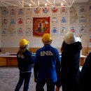
In Camerino, the activities of the ARCH project focussed on the acquisition of data from hi-tech sensors, including an urban seismic network, from in situ and laboratory tests, from surveys distributed to the population and to the public administrations. The collected data have then been transformed into useful information and knowledge, easily accessible and usable through user-friendly geodatabases and digital dashboards; the final goal in Camerino has been to support decision making processes to enhance resilience through disaster risk management strategies and build-back better strategies that could also include climate change adaptation measures.
Practical and easy to use, the ARCH Geoportal provides Camerino with real-time data trends about the hazardousness of the territory, the vulnerability of the built environment, the tangible and intangible values of monumental assets and art works within its historic area. The Camerino ARCH DSS dashboard, provides an overview about the tangible impact to the built environment and movable art works, the possible economic losses, and consequences on the population, for two scenarios of different severity; the same dashboard allows visualizing how and to what extent the same inputs can be significantly reduced by implementing some resilience measures.
The easy and shared access to data and knowledge support easily moving from monitoring to action with informed and conscious decisions about measures and strategies for a resilient post-disaster reconstruction to prevent, mitigate, manage future hazards preventing their escalation into disasters.
The commitment of ENEA, INGV and all the ARCH partners is now to transfer and replicate in other contexts the results produced within the ARCH for its pilots.
Foto e Video


Note
[1] https://www.mdpi.com/2073-445X/11/6/886 ( Sergio Cappucci, Serena Nappi, Andrea Cappelli)
[2] https://www.mdpi.com/journal/land/special_issues/geomatics_landscape Special Volume edited by Maurizio Pollino, Sergio Cappucci (ENEA) and Andrea Taramelli (IUSS PAVIA)