Italian National Agency for New Technologies, Energy and Sustainable Economic Development

MEDIA - Press office ENEA
Climate: COP28, ENEA presents Atlas of marine and coastal habitats
An innovative tool to protect marine habitats from climate change impacts, preserve marine habitats from the impacts of climate change, mitigate risk factors and plan a more sustainable use of marine areas, even in small island developing states (SIDS).
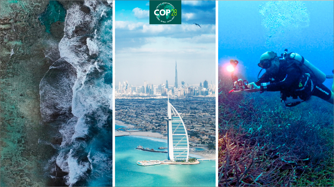
The Atlas of marine and coastal habitats is one of the innovations ENEA has presented at COP28, the United Nations conference on climate change (UNFCCC), which kicked off on November 30 in Dubai in the United Arab Emirates and where until December 12 world leaders, government representatives and delegates from 198 states will discuss various efforts to overcome the climate crisis.
The Atlas is part of a collaboration between ENEA and the Ministry of the Environment and Energy Security (MASE), active since 2015, whose purpose is to support Developing Countries (DCs) in activities and projects aimed at combating climate change and protecting biodiversity.
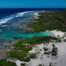
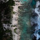
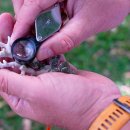
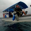
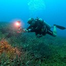
The innovative method is based on the use of satellite data, like Sentinel-2 and Landsat, integrated with free access processing and mapping platforms (SNAP, QGiS), in order to provide public decision makers with easy-to-use tools, updatable also locally. The Earth Observation System (EOS) technologies and the thematic maps produced with multispectral satellite data are then validated on the territory through surveys, diving, aerial and underwater drones and hardware and software tools for georeferencing the areas inspected.
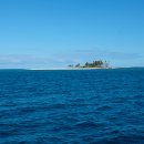
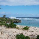
“All over the world, global warming, sea level rise and acidification, spread of alien species, extreme events and increasing anthropic pressures are threatening marine-coastal habitats,” pointed out Andrea Peirano at the ENEA Biodiversity and Ecosystem Services Laboratory. “Coral reefs, seagrasses and mangroves ecosystems are increasingly vulnerable, therefore it is crucial to provide decision makers with tools enabling them to identify the areas to be preserved, planning marine spaces use even in large remote, uninhabited and uncontaminated islands", said the researcher.
This innovative approach has already been successfully applied in two SIDS archipelagos in the western Pacific Ocean as part of the projects “Tonga: Strengthening Protected Area Management” and “Vanuatu: A National Marine Spatial Plan”, agreed between MASE and the Ministries of the countries involved.
ENEA researchers provided technical assistance to policy makers, creating a digital cartography of habitats, actual Atlases of coastal marine habitats, dynamic, queryable and updatable on the QGiS platform, created by processing satellite images of the Copernicus Project of the 'European Space Agency (ESA).
The Atlases, which feature ecological quality indices (EQI), include the classification of habitats, to easily identify the most valuable biosystems for each area of interest.
“The outcomes showed an over 88% consistency between remote sensing data and field data, proving the validity of the technique”, explained Mattia Barsanti at the ENEA Biodiversity and Ecosystem Services Laboratory. “In the Vanuatu archipelago, made up of 90 islands, 51% of the over 730 km2 of coastal marine habitats have the maximum value of the Ecological Quality Index. Seagrasses and mangroves, with an extension of 11 and 33 km2 respectively are among the most important coastal marine habitats, especially for their ecosystem functions", said the researcher.
Similarly, for the archipelago of the Kingdom of Tonga, over 998 km2 of marine-coastal habitats were mapped, of which over 404 km2 (~40%) of valuable marine-coastal habitats, with a maximum Ecological Quality Index value.
ENEA provides support to public decision makers in numerous activities:
- Interpretation of satellite images for digital coastal marine habitat mapping and marine spatial planning;
- Development of digital solutions for the management of coastal marine spaces;
- Monitoring biodiversity and the effects of climate change on the marine environment;
- Estimation of the value of marine environments through the Ecological Quality Index;
- Assessment of ecosystem services performed by mangroves, corals and seagrasses and associated benefits (sustainable fishing, tourism and Marine Protected Areas);
- Support for the definition of new Marine Protected Areas as urgent measures to safeguard biodiversity and tackle climate change;
- Identification of possible changes in uses of coastal marine areas;
- Development of geospatial data on the suitability of ocean energy sites (waves, currents, tides);
- Training and transfer of know-how on Remote Sensing and GIS (Geographic Information System) technologies.
Photos and videos